Character Areas & Design Codes
The Trawden Forest Neighbourhood Plan Design Code defines the essential character formed by the distinct villages and hamlets of Trawden, Winewall, Wycoller, Hill Top Trawden, Hollin Hall and Cotton Tree.
CA - 1
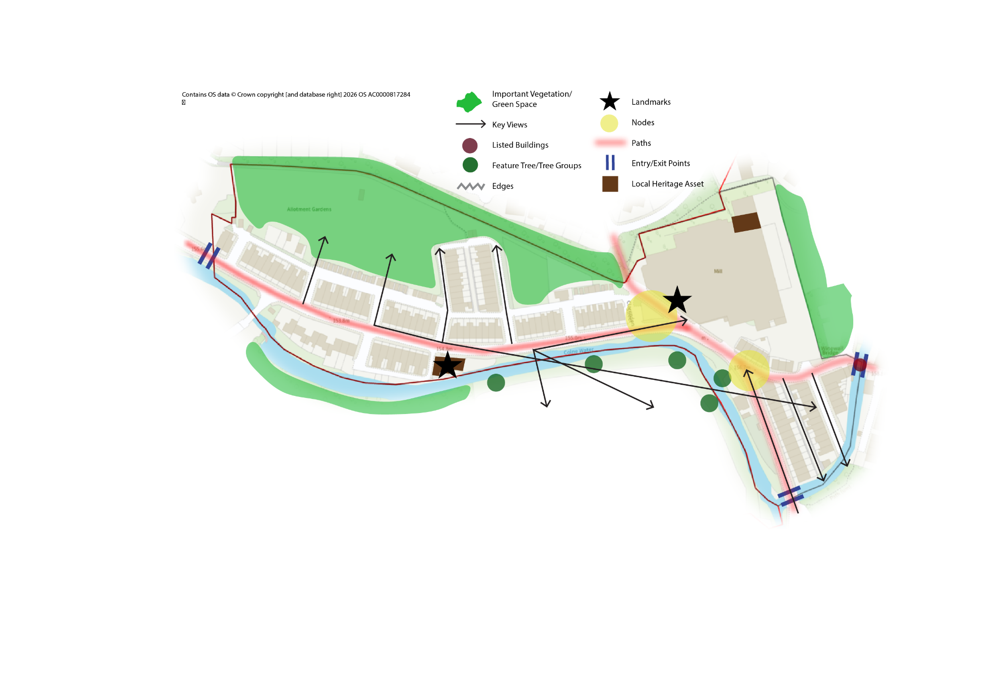
A 19C residential area built around the former Standroyd Mill at the foot of the hills leading up to Colne to the north and west and to Winewall to the east. The Colne Water river and its flood plain provide the setting to this relatively dense built up area.
CA - 5
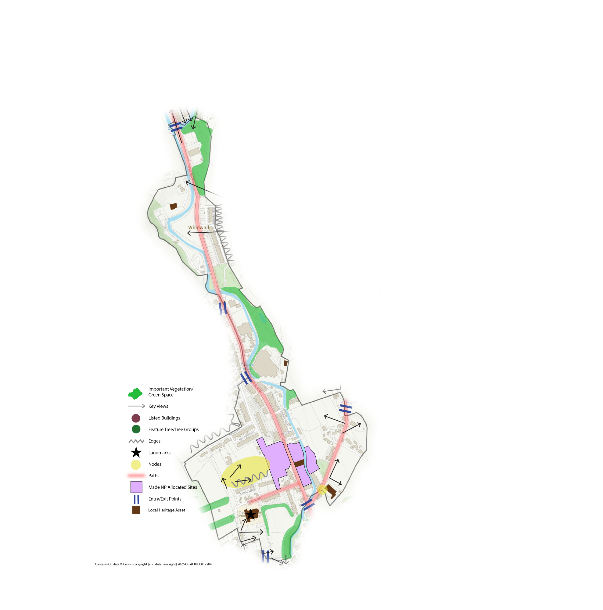
An historic hamlet rising up the main road from Trawden to Colne from Bearshaw Beck at the foot of the hill past Trawden House and its extensive grounds towards the top. A residential area that is quite distinct from Trawden.
CA - 2
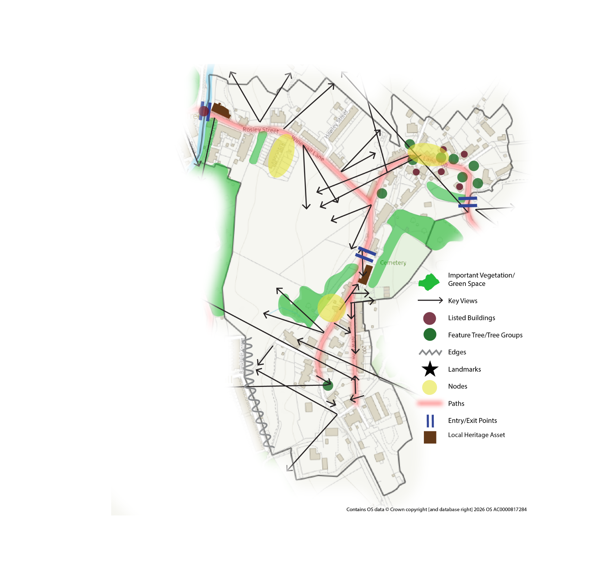
A 17C to 19C linear village on the hill between Colne and Wycollar with sporadic extensions south along the valley contours towards Trawden. A cluster of listed buildings at its historic centre on Lane Top.
CA - 6
A 19C and 20C residential area tightly arranged on a narrow single road that rises and falls along its length. Its low buildings and topography allow extensive views across to Boulsworth Hill and the south Pennines.
CA - 3
A 19C residential area developed along the valley floor to support the sequence of mills along the river bank. Steep valley sides separate from the wider countryside to the east and west.
CA - 7
This Character Area type is present in multiple locations: Holme Crescent , Leyland & Lachman Close estates and Beckside close adjoining the Trawden Brook Character Area; Boulsworth Drive estate off Bank Street where the adjoining Hollin Hall and Village Centre Character Areas meet and Weavers Court where the adjoining Hill Top and Trawden Brook meet.
CA - 4
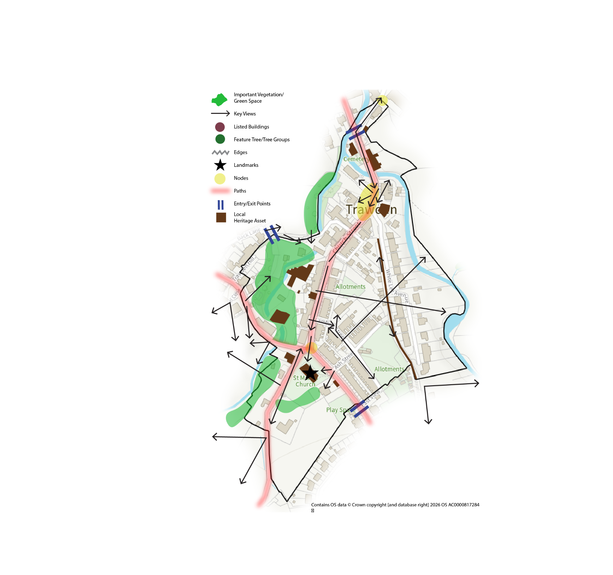
The historic core of Trawden village and a predominantly residential area but with a number of important community and commercial uses. Focused around the spine of Church Street from the foot of the hill at the confluence of Trawden Brook and Beardshaw Beck to St. Mary’s Church at the top.
CA - 8
Wycoller is a charming, car-free hamlet . Nestled in a peaceful valley, it features the 16th-century ruins of Wycoller Hall—reputed inspiration for Ferndean Manor in Jane Eyre - and ancient packhorse bridges crossing the beck
Character areas
CA1 - CA7
Seven character areas have been identified focused on the built-up areas of the Parish. They comprise modifications and additions to the Areas of Townscape Character identified in the made Neighbourhood Plan.
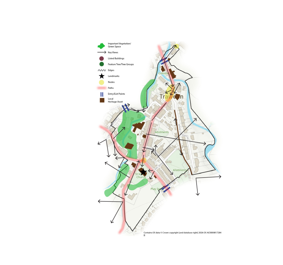
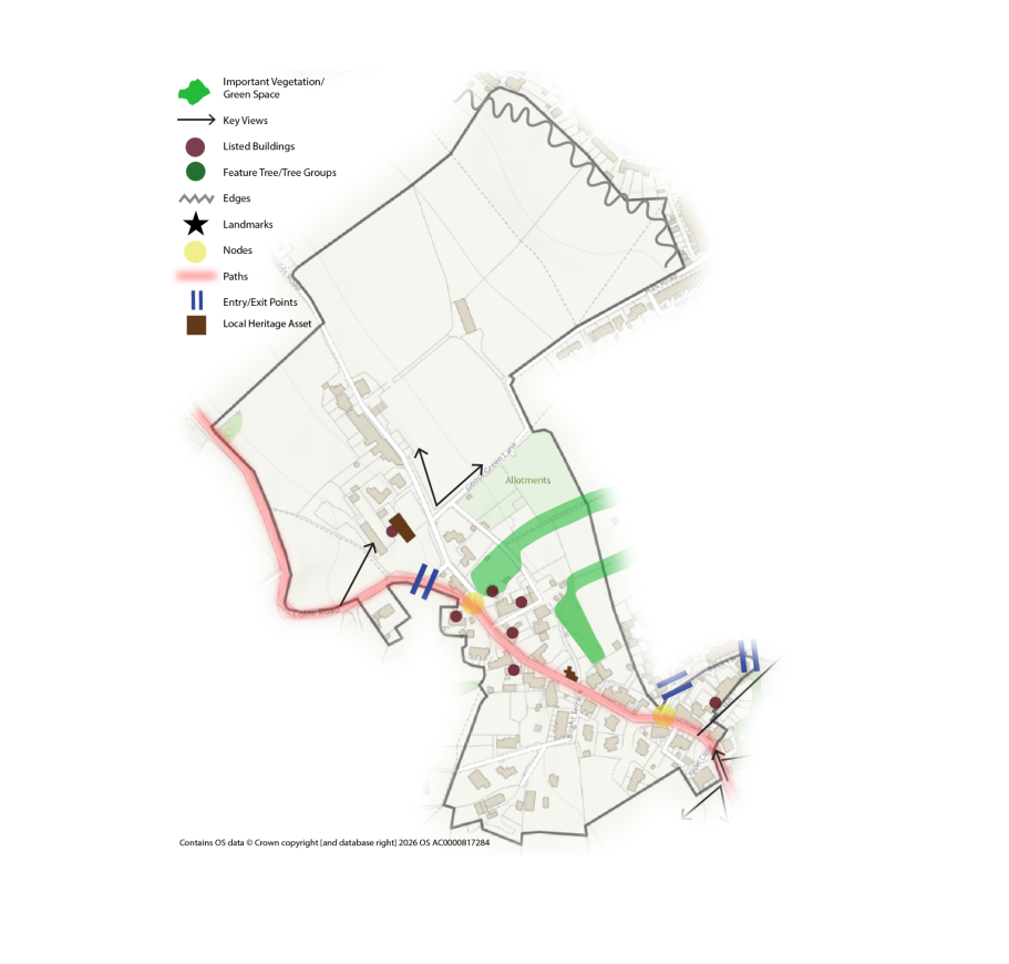
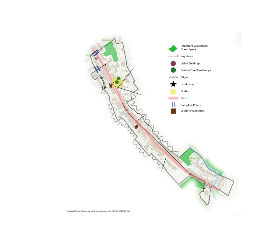
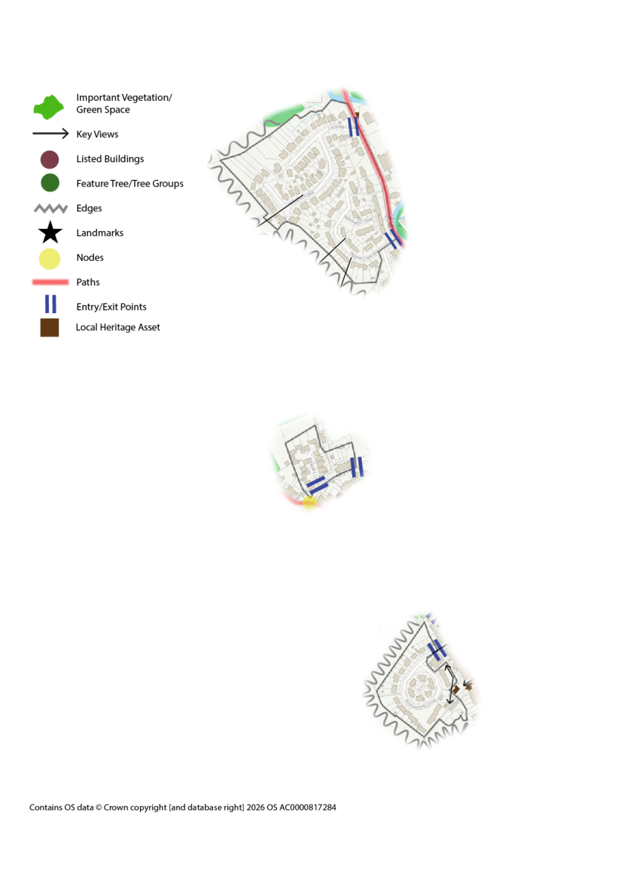
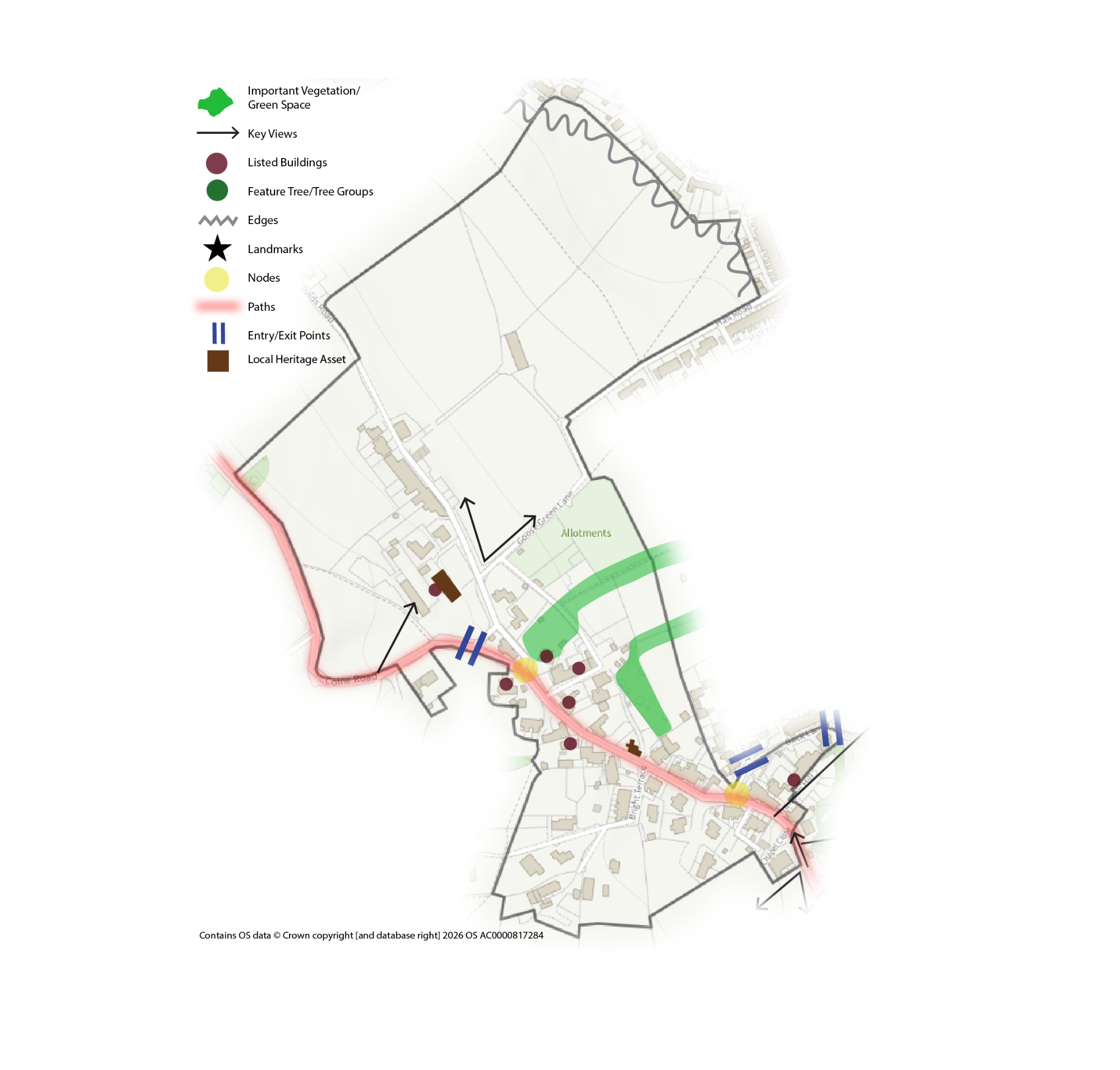
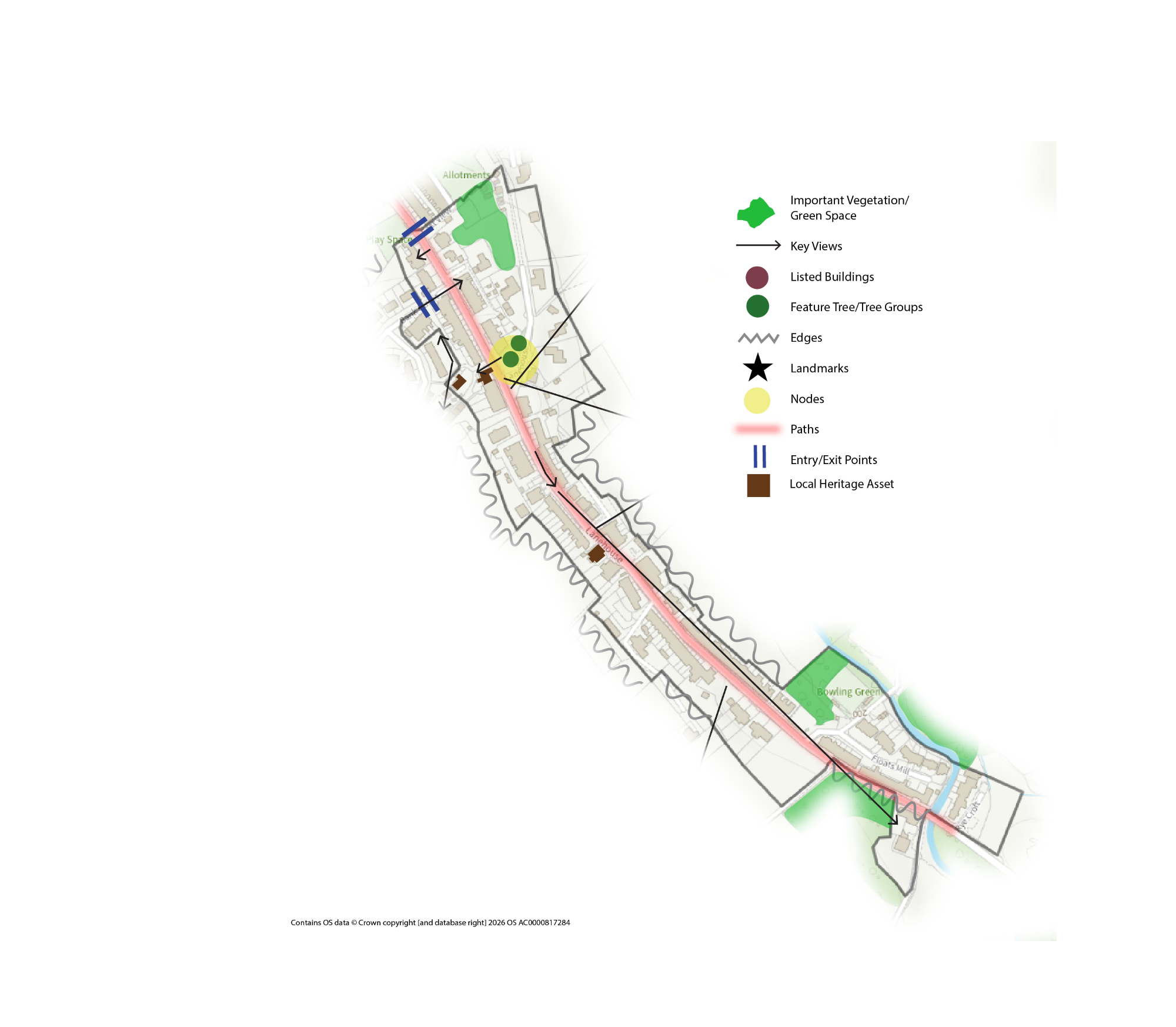
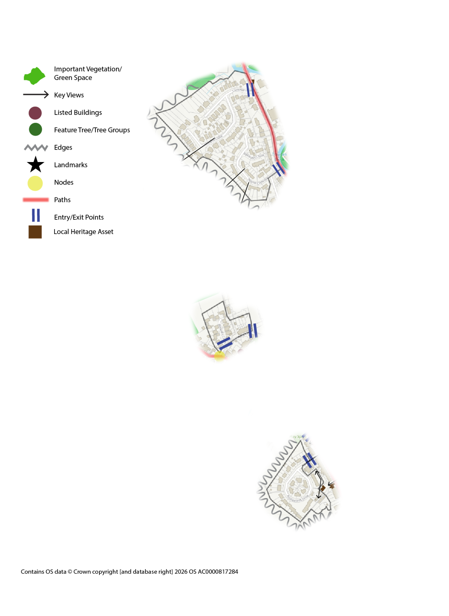
What type of development does the Code apply to?
The Code is largely intended to guide development proposals which require planning permission, including:
- Extending or converting an existing building
- Redeveloping an existing building(s) within plot(s)
- Erecting new buildings through the subdivision of a plot (for side or rear development)
- Erecting new buildings on vacant land within or on the edge of the settlement
The Code is intended to strike the right balance between prescription and flexibility. A level of prescription is necessary as the whole of the area covered by the Code is part of a designated Conservation Area, to which the duties of the 1990 Listed Buildings & Conservation Areas Act apply, i.e. conserving and enhancing its special architectural and historic character. However, some degree of flexibility may also be necessary to allow developers and property owners to innovate in responding positively to the Code. To achieve these twin objectives, the Code strikes this balance in different ways across the Code area to reflect its differences in character.
Design Code Structure:
The Code is structured around the national guidance for design and placemaking. In particular it uses Character Areas as the basis for character analysis and coding. The Areas reflect the distinct settlement areas that form the main built-up area from Cotton Tree at the northern edge of the Parish to Hollin Hall at its southern edge.
For each Character Area, the Code:
- Describes its key land use features
- Defines its significance in terms of the features that define its essential character and identity, including how the place is experienced
- Summarises the Conservation Area Appraisal analysis of its contribution to the Conservation Area
- Identifies any Listed Buildings and Local Heritage Assets, noting that the full description of the Listed Buildings is in the separate Statutory List held by Historic England and that there are some Local Heritage Assets identified by the Trawden Forest Neighbourhood Plan that lie outside the Character Areas
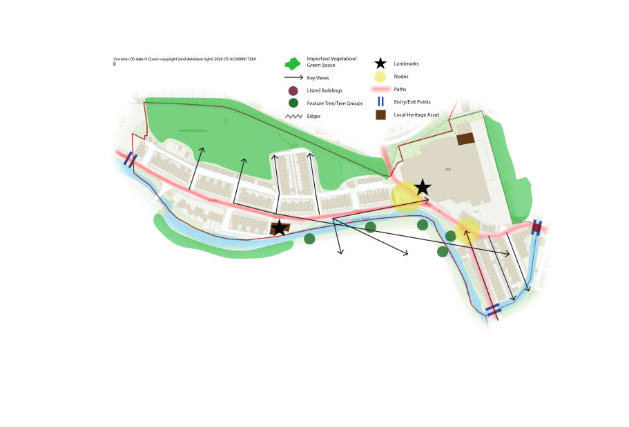
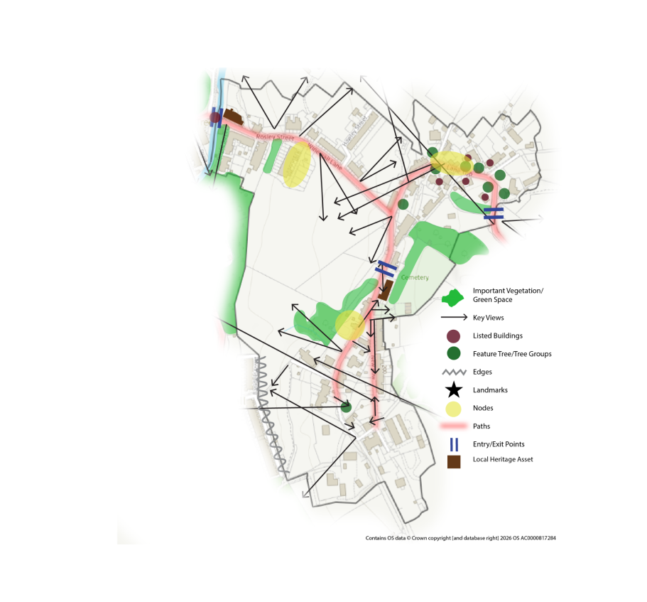
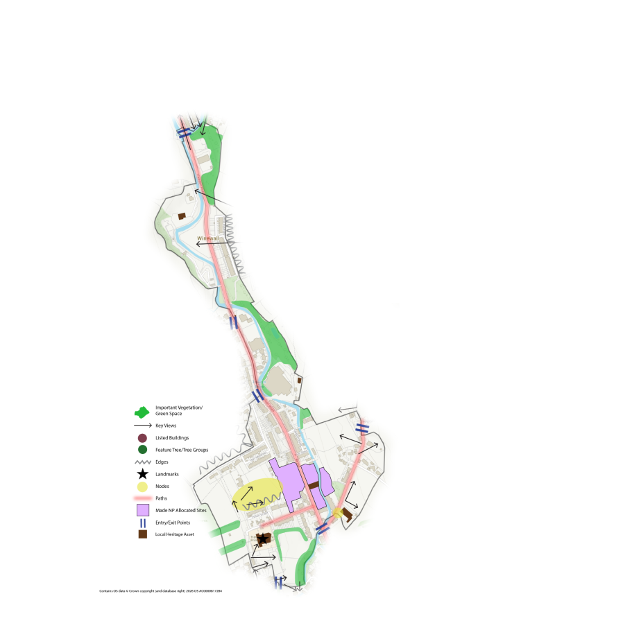
- Includes an Analysis Map to illustrate all these features
- Sets out a design strategy that recognises that some Character Areas are more less able to accommodate change through development, requiring different levels of design management (see below)
- Uses the 2026 National Design Code to set out the requirements of design proposals across a range of design criteria
- Identifies Opportunity Sites where development proposals may come forward in the future and sets out the key site-specific design principles
- Includes a gallery of photographs of features mentioned in the analysis
National Guidance on Design Coding:
National guidance on managing design in the planning process continues to evolve. The latest iteration is the draft Design and Placemaking Planning Practice Guidance published for consultation in January 2026. It offers practical advice on creating high-quality places and buildings and aims to outline and illustrate Government’s design priorities.
Its advice on producing a code for an area like Trawden Forest proposes that it should apply across multiple development types with shared characteristics, such as residential new build, small sites or specific street types. It should aim to raise baseline standards, offer certainty and streamline decision-making by addressing common, repeated design issues.
However, applying at a level smaller than the local planning authority, it should also respond to local character, including in heritage locations. Type-based coding still applies, unless there is evidence to vary them in response to specific constraints or needs.
Its technical guidance on setting design codes requires coding that:
- Is measurable using visual and numerical parameters rather than detailed policy wording
- Is simple, concise and specific to the development type or place that they apply
- provides developers certainty of what will be accepted to make the planning process more predictable and efficient
- raises the baseline standard of design quality and create consistency in the design and character of new and existing places
- allows flexibility and a suitable degree of variety, creativity and innovation.
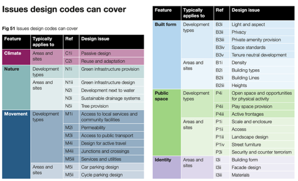
Finally, it lists the Issues that design codes can cover (see the illustration below).
Design Strategy :
In respect of setting out the design strategy for each Character Area the analysis has used the method inspired by AC Hall (1996). In practice there are four levels of design management ranging from the most permissive to the most stringent:
- Standards – the site location requires only the national design guide/code or planning-authority-wide coding standards to apply as its character area can accommodate many different building and plot forms.
- With the grain – the site lies within a character area that has some common patterns of roads, buildings and spaces that need to be followed but otherwise can accommodate schemes of a variety of buildings forms and styles.
- Form and style – the site lies within a designated ‘area of special character’ (or similar) whose local architectural and historic interest and distinct building forms and styles have survived and are clear enough to need greater design control.
- Conservation – the site lies within a designated Conservation Area where proposals must conserve and enhance its special architectural and historic significance.
Experience of Place:
Legibility plays an important role in framing the positive experience of a place. There are built and natural elements of a place that contribute to how a place is experienced, understood and remembered by people interacting with it. The Design and Placemaking Planning Practice Guidance says:
“The identity or character of a place comes from the combination of buildings, streets and spaces, landscapes and infrastructure and how people experience them. A place’s identity is not just about the buildings or how a place looks, but how it engages all the senses. Local character makes places distinctive and memorable and aids navigation. Well-designed, liveable places have a strong identity and create a sense of place and belonging. A sense of place makes somewhere special and memorable so people stay or return.”
To demonstrate these important elements edges, landmarks, nodes and paths have been identified for the built-up areas inspired by Kevin Lynch: The image of the city (1960) as follows:
- Edges are visible hard or soft boundaries that divide different areas. You can move through these boundaries in some cases, but they can also be a barrier. The key is that you are in a different place dependant on which side of the edge you are standing in e.g. town / country.
- Landmarks are prominent visual features that stand out from their surroundings, like towers, monuments, or distinctive buildings. Landmarks may have their own character but that is not essential. More importantly, they serve as reference points, helping people orient themselves and navigate around the area more effectively.
- Nodes are key points of social interaction or concentration, such as public spaces, parks and places where Paths converge. Nodes are often prominent places where people gather to enjoy and shop for example and so help people recognise where they are.
- Paths are the routes along which people move through the area, such as streets, footpaths, bridleways and cycleways. Paths are the most significant element because they connect places, channel the way people move about the area and therefore define how they experience the area.
Issues that design codes can cover